Tärnasjön
- Country:
- Sweden
- Site number:
- 29
- Area:
- 23,236.0 ha
- Designation date:
- 05-12-1974
- Coordinates:
- 65°56'12"N 15°32'56"E
Map
Photos
Overview
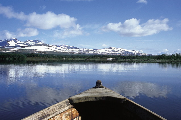
Located in the upper stretch of the Umeälven (Ume) river, the Site consists of a large alpine freshwater lake with an extensive archipelago, large mire complexes including the southernmost palsa mires in Sweden, numerous small lakes and a delta virtually unmodified by human activities. The Site has been extended to incorporate the Mire Protection Plan Site “Tärnasjön och Ånkardalen” and other wetland types, resulting in an increase in area of over 11,000 hectares. Vegetation is dominated by dwarf Betula scrub and a rich shoreline flora. Ånkardalen, in the southern part of the Site, is one of only four or five localities of the endemic species Gymnadenia runei. The Tärnasjön lake and the surrounding mire complexes are important for breeding birds, especially alpine waders and ducks. The Site regularly supports more than 1% of the Fennoscandia/Eastern Mediterranean population of the globally vulnerable lesser white-fronted goose Anser erythropus. The wetland is important to local Sami communities for fishing and reindeer herding. The area is also used for recreation such as nature observation and nature-based tourism. Recent studies have shown that the palsa mires in Laivadalen have severely deteriorated, as a result of a warmer climate during recent years. There is a management plan for the Site.
Administrative region
Västerbotten County
National legal designation
- nature reserve - Vindelfjällen
Regional (international) legal designations
- EU Natura 2000
Last publication date:
09-01-2017
Download
Ramsar Information Sheet (RIS)
- SE29RIS_1701_en.pdf
- SE29RISformer_150218.pdf
- SE29_map1503.pdf
- SE29_ECD1503.docx