Guangxi Beihai Jinhaiwan Mangrove Wetlands
- Country:
- China
- Site number:
- 2508
- Area:
- 1,357.8 ha
- Designation date:
- 28-10-2022
- Coordinates:
- 21°24'28"N 109°12'E
Map
Photos
Overview
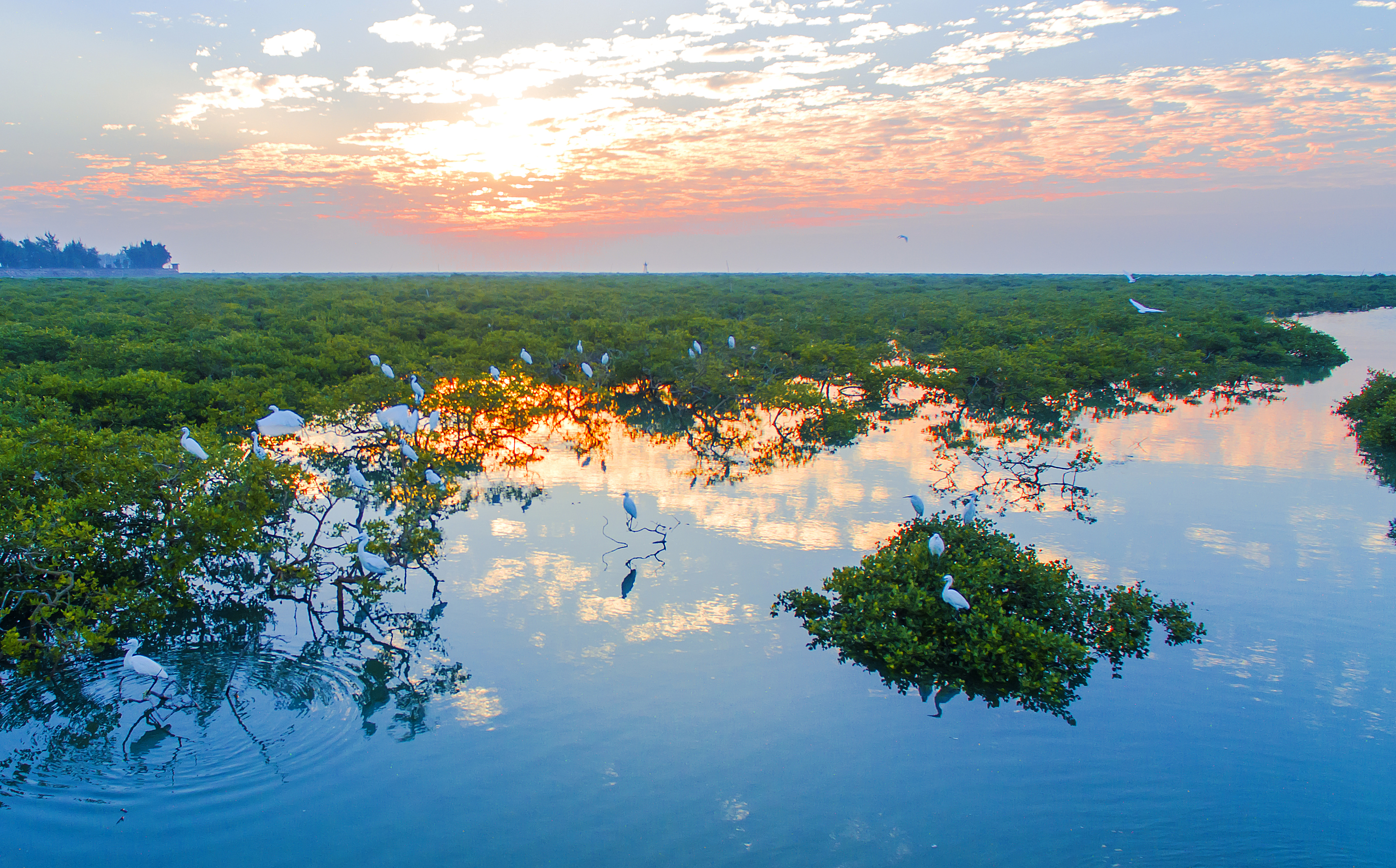
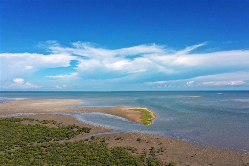
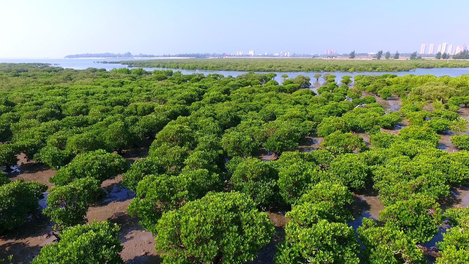
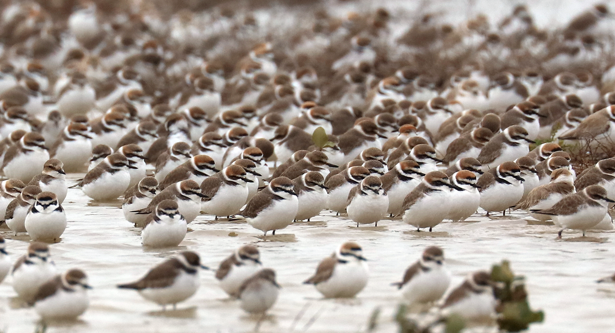
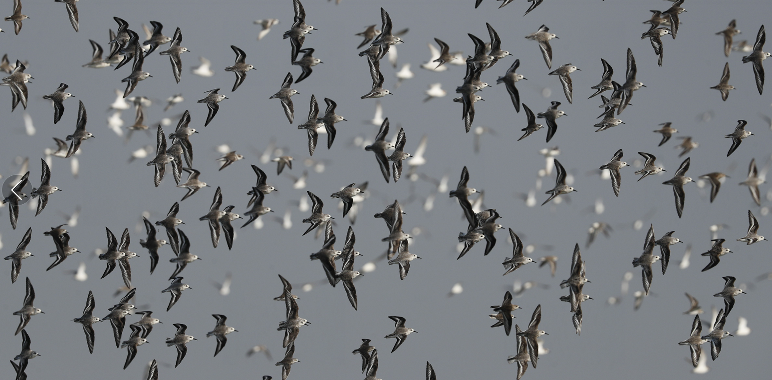
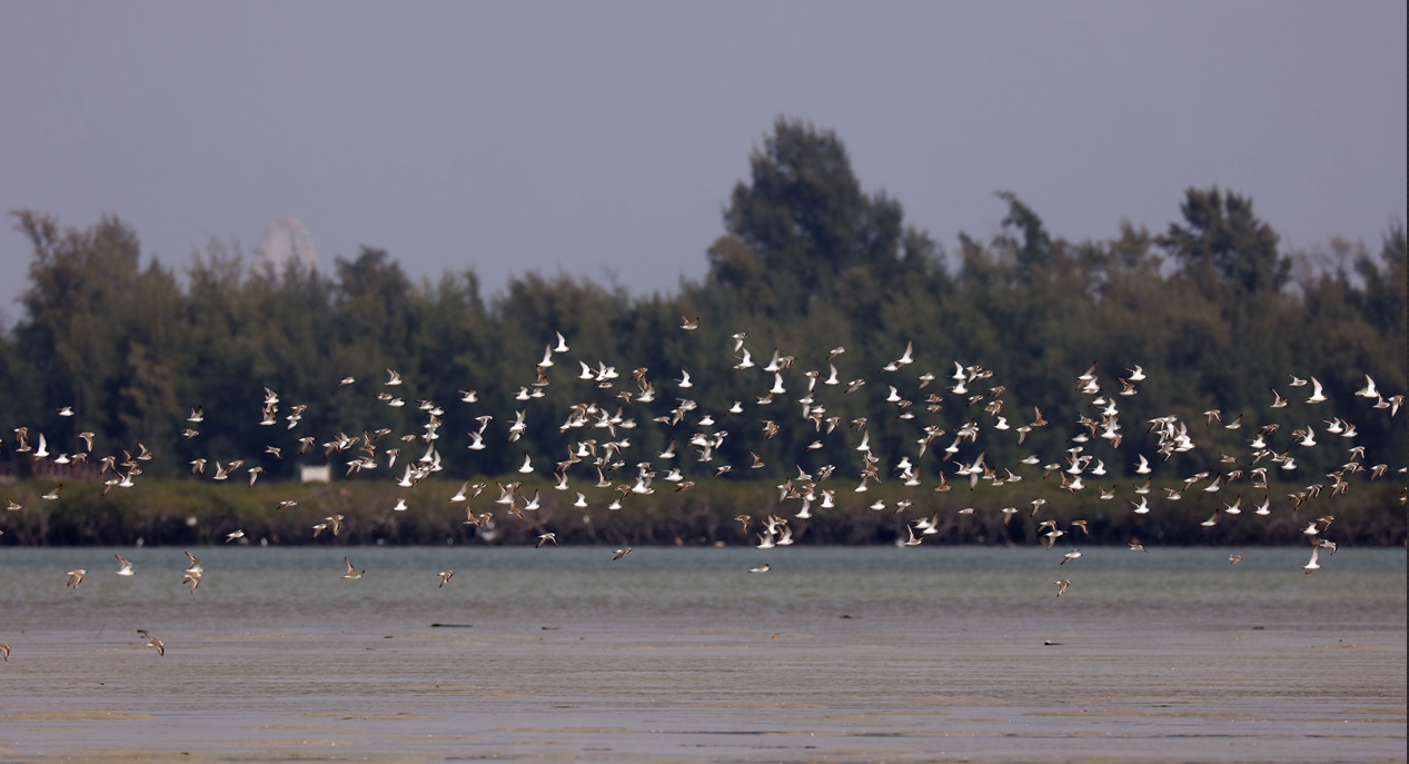
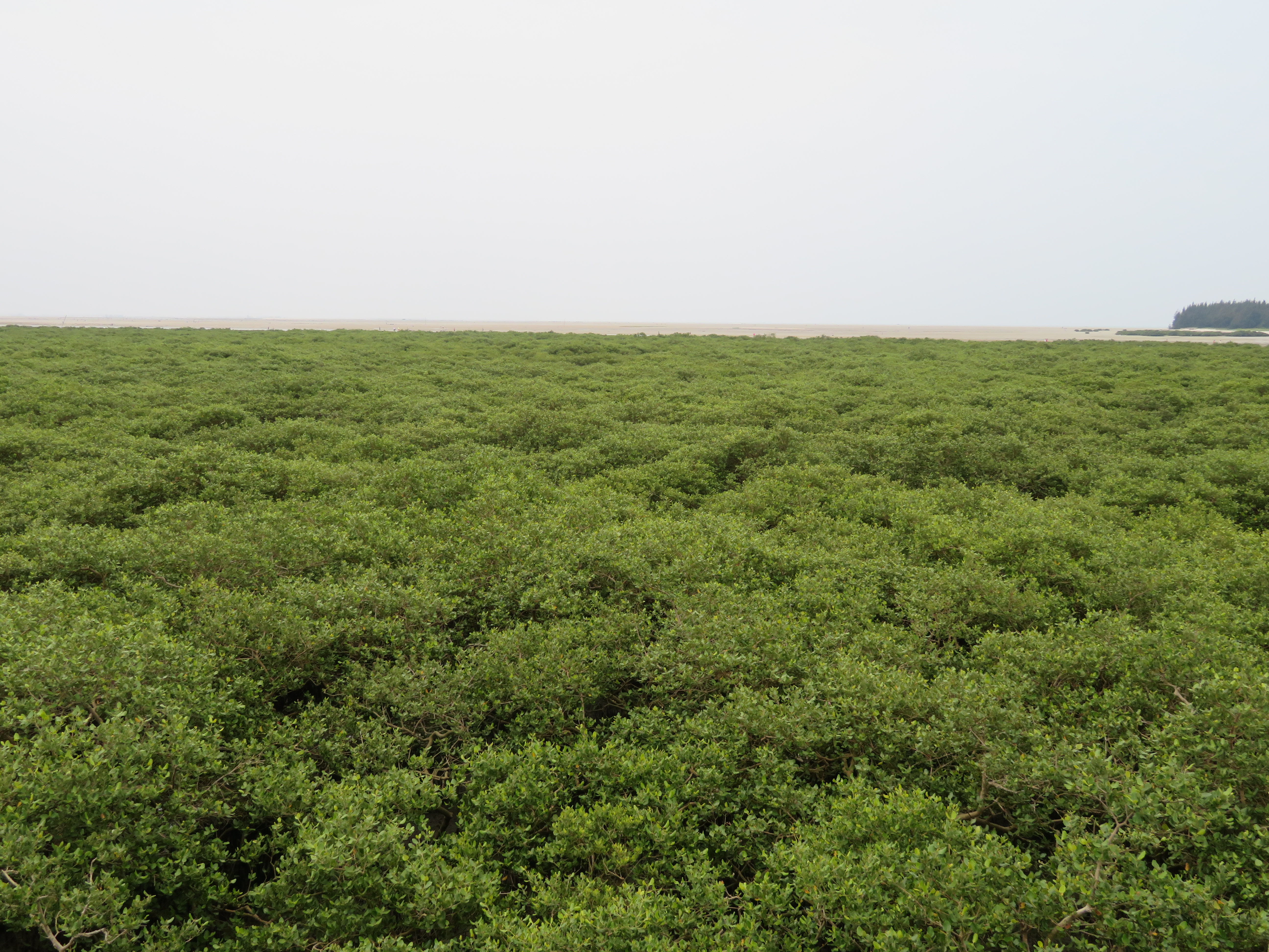
The Site is located in the coastal area of Beibu Gulf in the South China Sea and lies in the Guangxi Beihai Binhai National Wetland Park. It consists of offshore and coastal wetlands, including the Fengjiajiang River, Liyu Di reservoir, sandy and gravel beaches, estuarine waters, mangroves and intertidal mudflats. The mangrove forest is spread out over 147 hectares and is mainly composed of seven native mangrove species, dominated by the gray mangrove (Avicennia marina). Various threatened birds including great knot (Calidris tenuirostris) and black-faced spoonbill (Platalea minor) are found, migrating on the East Asian – Australasian Flyaway. The Site is also one of the critical spawning and nursery areas for the only two species of horseshoe crabs in the country, the tri-spine horseshoe crab (Tachypleus tridentatus) and mangrove horseshoe crab (Carcinoscorpius rotundicauda). In addition to its important role in biodiversity conservation, the Site provides ecological services such as carbon sequestration, floodwater storage and coastal zone protection.
Administrative region
National legal designation
- National Wetland Park - Guangxi Beihai Binhai National Wetland Park
Last publication date:
Download
Ramsar Information Sheet (RIS)
- CN2508RIS_2304_en.pdf
- CN2508_map230210.jpg