Las Salinas de Huentelauquén (LSH)
- Country:
- Chile
- Site number:
- 2237
- Area:
- 2,772.0 ha
- Designation date:
- 02-02-2015
- Coordinates:
- 31°34'35"S 71°33'24"W
Map
Photos
Overview
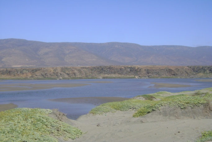
This Ramsar Site includes the last section of the Choapa River and its extensive estuarine lagoon. Its diverse coastal ecosystems such as beaches, flats, sand dunes, and streams support a great biodiversity. Among the species that use the Site are 148 species of birds, 10 of reptiles, 14 of mammals, 4 of amphibians, and 133 plant species. Some of these are threatened or endangered such as the marine otter (Lontra felina), the Chilean toad (Calyptocephalella gayi) and Eriosyce chilensis. The Site also receives 28 species of migratory birds that use it for feeding, resting or wintering. Resident bird species also use it as an area for post-reproductive aggregation. Fish and crustaceans which support the local economy, such as Mugil cephalus and the endemic river shrimp Cryphiops caementarius, reproduce at the Site. The threats to the Site include the introduction of common carp (Cyprinus carpio), an invasive species, and the use of increasingly technical agricultural processes that include the unregulated use of pesticides. Other threats include mining and climate change.
Administrative region
Coquimbo
National legal designation
- Area Prohibida de Caza - Area Prohibida de CazaHuentelauquén y ecosistemas adyacentes
Last publication date:
25-08-2015
Download
Ramsar Information Sheet (RIS)
- CL2237RIS_1508_es.pdf
- CL2237_map1503.jpg
- CL2237_taxo1504.pdf