Presa Manuel Ávila Camacho
- Country:
- Mexico
- Site number:
- 2027
- Area:
- 23,612.0 ha
- Designation date:
- 02-02-2012
- Coordinates:
- 18°55'N 98°10'58"W
Map
Photos

Overview
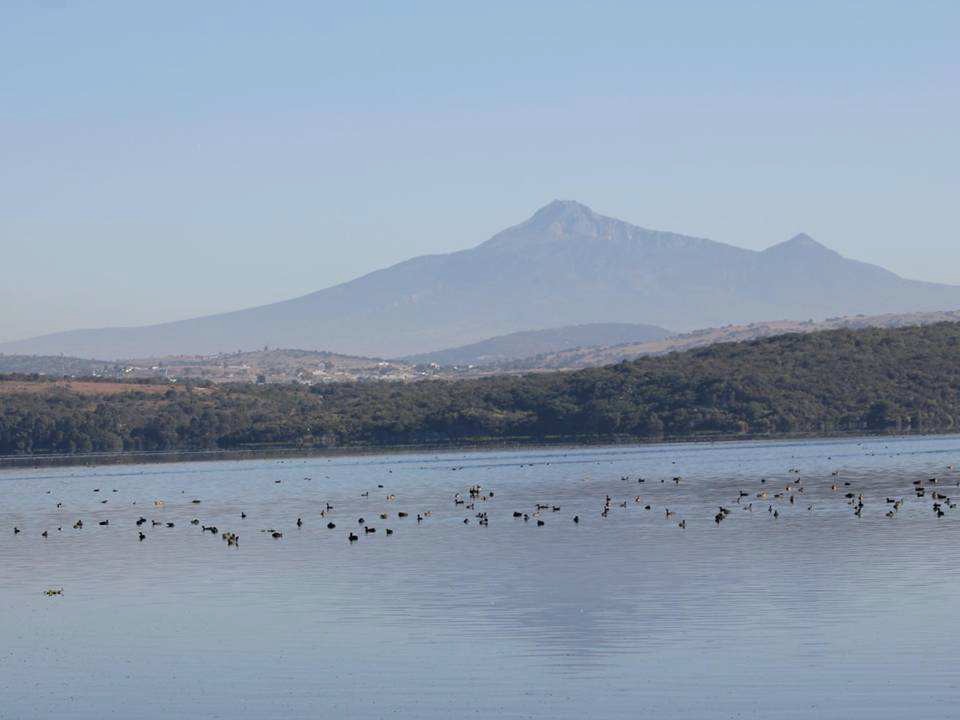
Presa Manuel Ávila Camacho (Presa Valsequillo). 02/02/12; Puebla; 23,612 ha; 18º55'00"N 098º10'58"W. Located on the southern side of the municipality of Puebla, the site is part of a network of conservation sites and part of an important wildlife corridor. It is also a center where three key endemism areas of the ecoregions Temperate Sierras and Dry tropical forest converge. The site provides refuge to at least 97 species of migratory birds, representing at least the 42% of the species recorded in the site. It also harbors a wide range of species of birds, mammals and reptiles under national protection, as well as the IUCN Red-Listed Chestnut-collared Longspur (Calcarius ornatus). Besides the ecological services that it provides, the long cultural history of the site is an important heritage of humanity. Its zone of influence provides considerable documentation of prehispanic civilizations, including the oldest evidence of human presence in America, and the present city, founded in 1531, was one of the most important colonial cities and is now Mexico's fourth largest. Challenges to the site include urban and industrial growth; and deforestation is a problem for the whole area. Ramsar Site no. 2027. Most recent RIS information: 2011.
Administrative region
Puebla
National legal designation
- ANP - Reserva Estatal Sierra del Tentzo
- Zona de Preservación Ecológica Municipal - Sierra del Tentzo
Last publication date:
02-02-2012