Veerse Meer
- Country:
- Netherlands (Kingdom of the)
- Site number:
- 1251
- Area:
- 2,539.0 ha
- Designation date:
- 29-08-2000
- Coordinates:
- 51°32'52"N 03°43'07"E
Map
Photos
Overview
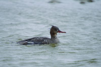
Formerly part of the Oosterschelde estuary (closed in 1961), the Site is now a 20-kilometre-long stagnant brackish lake with sandbanks and small islands, surrounded by wet meadows, improved grasslands, arable lands and some wood plantations. The Site boundary was aligned with that of the Natura 2000 site in 2014; farmland and the dyke separating the western end of the lake from the North Sea were excluded, reducing the total area by 38 hectares. Veerse Meer hosts more than 20,000 waterbirds in peak season and provides refuge to more than 1% of the biogeographic population of Eurasian wigeon (Anas penelope). The lake acts as a storage basin for surplus water pumped from the surrounding polders until it is discharged into the Oosterschelde. Human uses include commercial fishing, farming, tourism and boating. The Site is threatened by nutrient pollution causing eutrophication, and by recreational activities and the Midden-Zeeland airport, which cause disturbance to birds. In 2004 a sluice was constructed in the Zandkreekdam, which separates the eastern end of the lake from the Oosterschelde, to allow more natural water management and improvement of the water quality.
Administrative region
National legal designation
- National Ecological Network (NEN) - Veerse Meer
Regional (international) legal designations
- EU Natura 2000
Last publication date:
Download
Ramsar Information Sheet (RIS)
- NL1251RIS_2211_en.pdf
- NL1251RISformer_210608.pdf
- NL1251RISformer_EN.pdf
- NL1251_map211025.pdf