Ghodaghodi Lake Area
- Country:
- Nepal
- Site number:
- 1314
- Area:
- 2,563.0 ha
- Designation date:
- 13-08-2003
- Coordinates:
- 28°40'59"N 80°57'E
Mapa
Photos


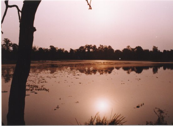

Vista general
Ghodaghodi Lake Area. 13/08/03; Kailali District; 2,563 ha; 28°41'N, 080°57'E. A large and shallow oxbow lake with associated marshes and meadows surrounded by tropical deciduous forest on the lower slopes of Siwalik, the youngest mountain range of the Himalaya in Western Nepal. There are around 13 associated lakes and ponds, and some streams separated by hillocks situated on the site's periphery. The forest and wetlands serve as the wildlife corridor between the lowland and the Siwalik. They support critically endangered Red-crowned Roofed Turtle (Kachuga kachuga), endangered Tiger (Panthera tigris), Three-striped Roof Turtle (Kachuga dhongka); vulnerable Smooth-coated Otter (Lutra perpiscillata), Common Otter (Lutra lutra), Swamp deer (Cervus duvaucelli), Lesser Adjutant Stork (Leptotilos javanicus) and Marsh Crocodile (Crocodylus palustris), endangered Orchid (Aerides odorata), religiously important and threatened Lotus (Nelumbo nucifera), and rare wild rice (Hygrohiza aristata). The lake is an important religious place with a shrine dedicated to Ghodaghodi deity where indigenous Tharu people celebrate a traditional festival, Agan Panchami, in December and take a holy bath in the lake. Due to dense population within the site (around 6,700 people of whom 50% are illegal immigrants from adjoining hilly areas), it is intensively used for traditional fishing and agriculture. The factors putting pressure on the site's ecology include highway traffic at the southern edge, construction of unplanned new temples, over grazing, poaching and hunting as well as illegal tree felling and smuggling of Sal (Shorea robusta) and Khair (Acacia catechu) timber, natural eutrophication accelerated by human religious and agricultural activities. Nevertheless with the help of IUCN Nepal, the users' groups of local communities and NGOs are involved in the conservation process which has helped to reduce poaching, initiate fencing towards the highway to control grazing and encroachment, and develop a participatory community-centered management plan. Ramsar site no. 1314. Most recent RIS information: 2003.
Administrative region
Seti Zone
Last publication date:
13-08-2003